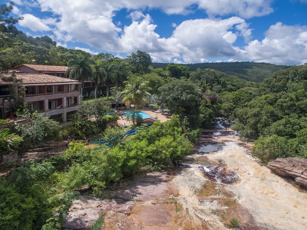
Lençóis, Bahia

Destination
Explore the unique ecosystems of Chapada Diamantina! Discover trails in national parks, waterfalls, and incredible landscapes in Bahia.
Chapada Diamantina · BA · Brasil
Photos
Discover the landscapes and culture of Chapada Diamantina
Editorial guide with history, culture, and practical tips to plan your trip.
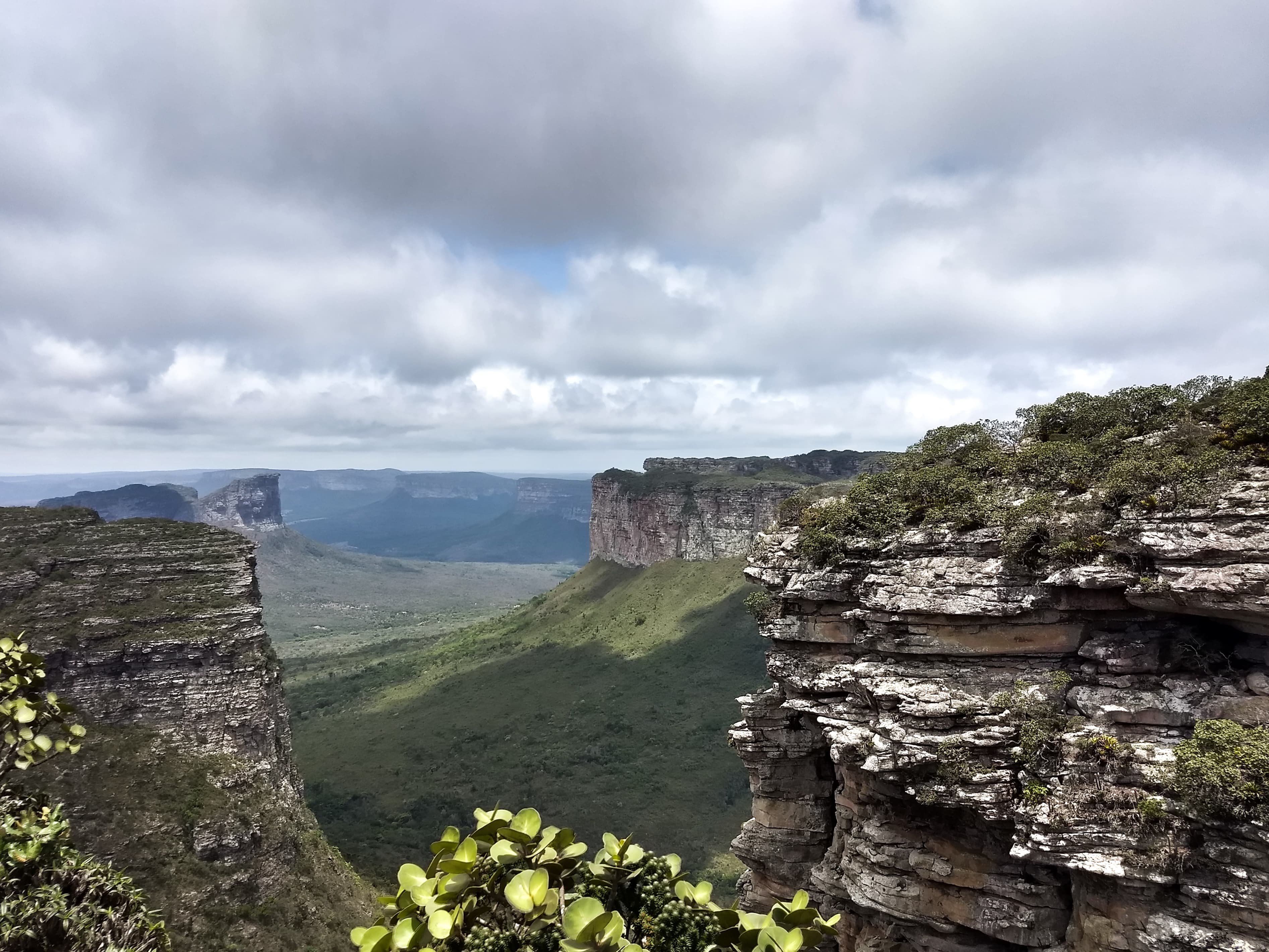
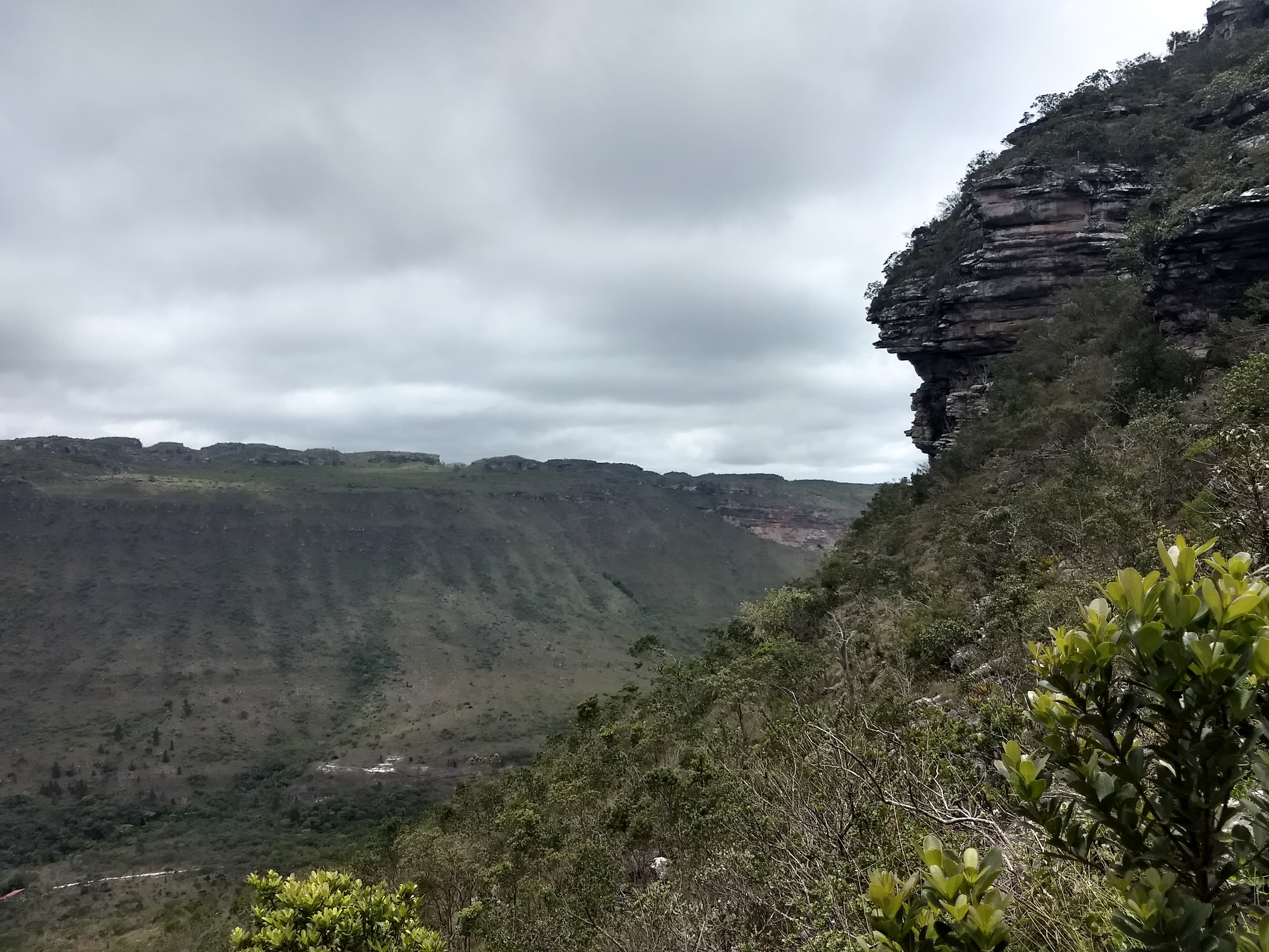
Chapada Diamantina is much more than a destination; it is an immersion into one of Brazil's richest and most geologically fascinating biomes. Located in the vibrant heart of the state of Bahia, this mountain region stands out for its dramatic landscapes, where vast plateaus meet deep canyons and lush forests. The name refers to the historical period of diamond mining, but what truly fascinates modern visitors is the magnitude of its biodiversity and the complexity of its ecosystem.
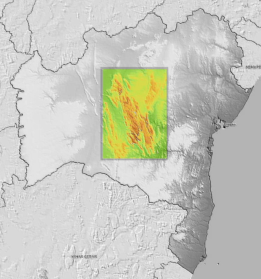
This extensive plateau is not just a point on the map; it is a geological testament. It is part of a vast mountain range known as the Espinhaço Range (Cadeia do Espinhaço), a formation that covers a considerable area—corresponding to about 15% of the state of Bahia's territory. In this majestic and diverse setting, the traveler can connect with ancestral trails, crystalline rivers, and natural heritage protected by various government spheres.
The region is recognized for its ecological uniqueness. Its landscapes vary drastically, allowing different Brazilian biomes to coexist in relative proximity: from the aridity of the Caatinga to the density of the Cerrado and unique rupestrian fields, while even retaining vestiges of the Atlantic Forest (Mata Atlântica). This mix of ecosystems gives Chapada Diamantina an unparalleled status as a conservation area and adventure destination.
The history of Chapada Diamantina is deeply linked to its ancient geological past, which predates any human occupation. The first chapter of this region was written millions of years ago, during the Pre-Cambrian period. It is in this deep time that the crystalline rocks forming the entire plateau were created.
In geological terms, the formation of the Plateau is a grand and slow process. The massif is not merely a series of hills; it constituted itself as a natural and robust extension of the famous Espinhaço Range. This origin in crystalline shield guarantees the landscape its resilience and dramatic appearance, shaped by time and the forces of natural erosion.
If we go back to the more recent period, the name "Diamantina" refers to the mining cycles that once animated the region. Although rivers and mountains were sources of life for populations long before European arrival, the economic peak is intrinsically linked to the search for diamonds. This human history, marked by the extraction of valuable resources, now coexists with a growing focus on environmental preservation and responsible ecotourism.
Although Chapada Diamantina is celebrated for its grand natural landscapes—which are its main postcard—it also holds a rich culture, shaped by people who learned to live with the power and limitations of this environment. Local life is marked by resilience and deep respect for traditions linked to the land.
The interaction between native peoples and colonizers established popular knowledge profoundly connected to natural cycles, grazing trails, and abundant water resources. The very structure of the region, with its various communities embedded in the plateau, creates a culture that is a fusion of the Bahian *sertanejo* (country dweller) with the adventurous spirit of modern explorers.
Local folklore and festivities still reflect this mix of cultures. The slow, contemplative pace of the main towns in Chapada Diamantina invites visitors to slow down, to reconnect with a way of life closer to nature. It is a culture where the river dictates the rhythm and the altitude imposes the pace.
Chapada Diamantina occupies a central and strategic position in the state of Bahia. It is defined as a majestic mountain region, forming an integral part of the gigantic plateau that constitutes the Espinhaço Range. This vast massif not only demarcates much of Bahia's topography—representing about 15% of the state—but also plays a crucial role in regional hydrography.
Geographically, the location is notable for its function as a water source (springhead). Almost all rivers belonging to the important basins of Paraguaçu, Jacuípe, and Rio de Contas originate here. It is a true aquatic cradle for much of northeastern Brazil.
The altitudes reached in Chapada are among the highest in the Northeast Region. The absolute highlight is Pico do Barbado, which reaches impressive 2,033 meters, along with other notable peaks like Pico do Itobira and Pico das Almas. This high altitude contributes to the region's scenic grandeur. Its Pre-Cambrian crystalline shield formation gives it a robust geological structure, making it a natural extension of this historical mountain range.
Due to its size and diversity of altitudes and vegetation formations, Chapada Diamantina does not have a homogeneous climate. Its complex geography results in distinct microclimates that shape the diverse biomes found. This climatic variation is why the region manages to house both Caatinga and Cerrado.
The transition between these ecosystems means seasonal and temperature variations throughout the year. In some areas, the landscapes reflect the semi-arid characteristics of the caatinga, while in others, the humidity is sufficient to sustain dense rupestrian fields or even remnants of the Atlantic Forest in the form of vegetational islands.
It is important to note that this climatic and vegetative variety is part of its appeal. The interaction between different biological zones creates a fascinating natural mosaic for the traveler, ensuring diverse landscapes regardless of the season.
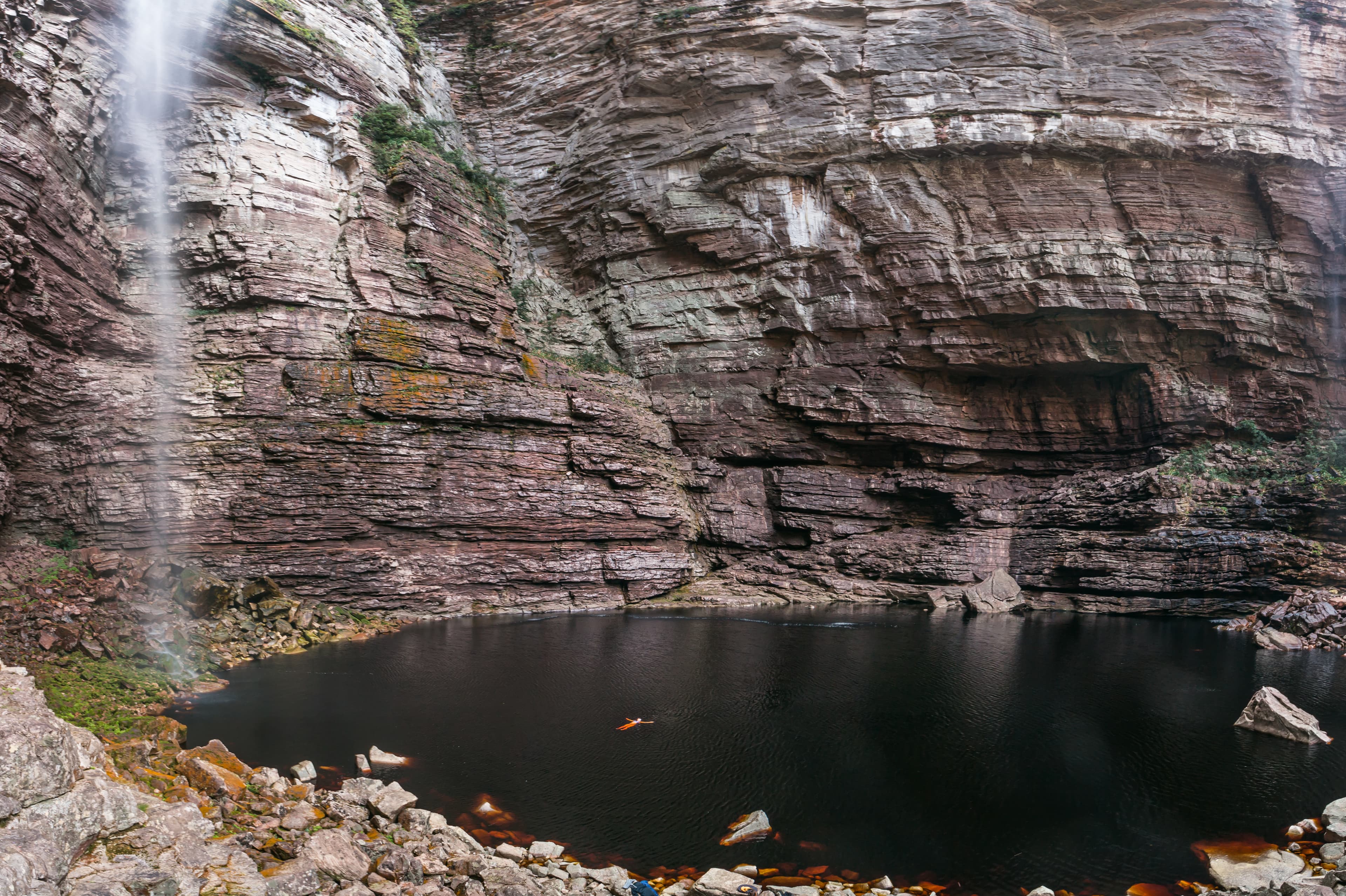
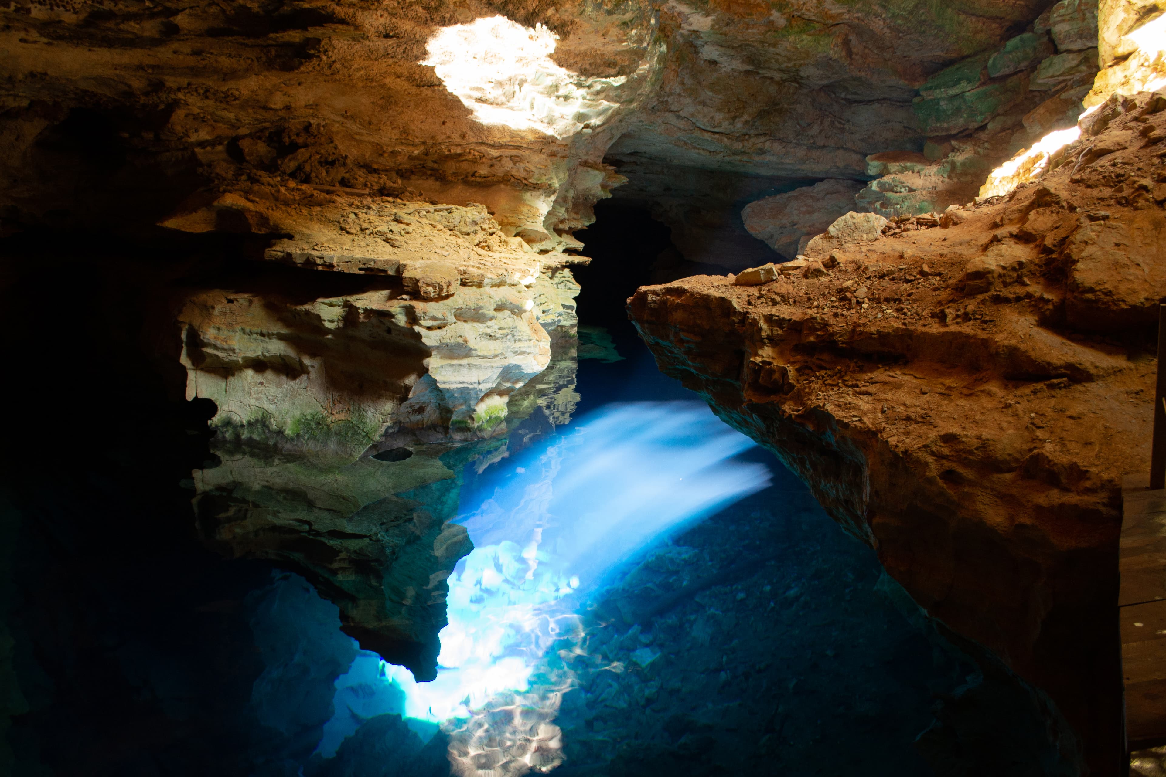
Tourism in Chapada Diamantina is fundamentally based on ecotourism and low-impact adventure. Activities are designed to allow visitors direct contact with the natural magnitude of the region's peaks, rivers, and caves.
The trails offer an immense variety of experiences, from light walks through flowering valleys to more challenging treks towards the highest points, such as Pico do Barbado or Itobira. Exploring the rivers and waterfalls is also a central axis of tourism, allowing invigorating baths after long journeys.
The destination is highly structured by various environmental protection areas—covering federal, state, and municipal spheres. Notable examples include the Chapada Diamantina National Park (PNASD), the Morro do Chapéu State Park, and the Marimbus-Iraquara Environmental Protection Area. The existence of these areas guarantees not only the preserved beauty of the landscapes but also a growing and responsible tourism infrastructure.
What makes Chapada Diamantina such a peculiar place is the way it has managed to preserve multiple Brazilian ecosystems within its territory. It acts as a gigantic living natural museum, where the Caatinga coexists side-by-side with the Cerrado and Rupestrian Fields.
Geologically speaking, there is a striking curiosity: this region is a Pre-Cambrian crystalline shield. This means that the rocks forming its mountains are incredibly old, witnesses to geological eras long before the dinosaurs or the emergence of Brazil as we know it.
The area's water importance is another peculiar feature: it not only houses important rivers but literally serves as a vital reservoir for large hydrographic basins—Paraguaçu, Jacuípe, and Contas. This biological function makes it strategic for the environmental balance of an entire region of the Northeast.
Everything you need to know to plan your trip
Currency
BRL
Language
Portuguese
Reference figures to help plan your trip
Attractions
9
Selected stays available to book
Hotels and experiences in the area
Everything you need to know to plan your trip
It is a mountain region located in the center of the state of Bahia, forming an extension of the Espinhaço Range. Its vast geological formation corresponds to 15% of the State of Bahia.
The region has some of the highest altitudes in northeastern Brazil, including Pico do Barbado (with 2,033 meters), as well as other peaks like Itobira and das Almas.
The landscapes are extremely varied, including Caatinga, Cerrado, rupestrian fields, and even Atlantic Forest islands.
Yes. There are several environmental protection areas (federal, state, and municipal) where you can explore nature, such as the Chapada Diamantina National Park, the Morro do Chapéu State Park, and the Marimbus-Iraquara Environmental Protection Area.
Yes. Chapada Diamantina is the birthplace of almost all rivers belonging to the Paraguaçu, Jacuípe, and Rio de Contas basins.
Its formation is part of a crystalline shield, making it geologically very old and formed in the Pre-Cambrian period.
Extend your trip to incredible destinations nearby
We personalize every moment of your journey — from iconic landmarks to hidden cultural gems.
Available 24/7 · Personalized consultations · Local expertise
Updated on June 7, 2026
Sources


